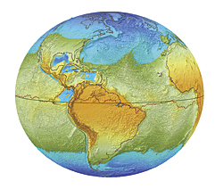
Well with the help of ArcGIS (which we have for use at the map library) we can see.
Through predicting how the changes in gravity would change the water masses and where they would settle.
Michigan would not only be great lake-less we would also be a part of the newly formed oceans!
To read up more, the full article here.
Thursday, July 29, 2010
Friday, July 23, 2010
What is new this week? Well...

This week consisted of moving furniture. ( We have a wonderful new reference desk!)
And going through quite a large donation to weed out duplicates and giving nearly every item a wipe down. The boxes were kept in a garage, many maps were musty, a handful moldy and worst of all a few had been affected by mice in various ways, altogether a messy job.
Like most moves this process is messy too,

but in the end ( well near end...) it looks new, updated and results in many comments on the layout.

The change has been a success with new patrons going to the actual reference desk rather than weeble wobbling between the desks in an attempt to grab the right persons attention.
What do you think?
Thursday, July 22, 2010
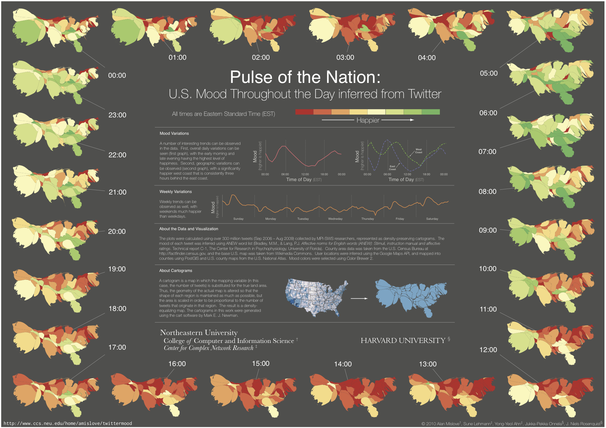
How happy is the nation?
A recent study by researchers from Northeastern University and Harvard University of twitter data has given us an interesting look into the nations moods. With a simple idea in mind we are able to see how moods fluctuate of those who tweet over a 24 hour period. Words are given a rating, Happy or sad and with the resulting data the scientists were able to see how moods naturally fluctuated in zones through out the day and through out the week. Sundays are a high point for most, with Thursday being the down point in the week pointing to the 5 day work week of many.
Wednesday, July 21, 2010
Where are the trees?

NASA, in an attempt to see where " missing" Carbon goes and if our forests can handle the amount we are pushing out every day, has taken a scan of our world and as a result we have a detailed Map of Global Forest Heights. The map is a first of its kind, showing the whole world in one scan giving the relative canopy height of the forests.
Wednesday, July 14, 2010
Hello!
Welcome to the University of Michigan's Map Library Blog.
From here on out regular updates will be made of events happening in the area, interesting articles, images, and updates to our collection.
To start off currently in the Audubon Room from now until September 20th from 8:30- 7 there is an exhibit entitled " Tour de France: Travel & Topography in France 1700-1900". This exhibit allows us to shows off some of our more interesting and rare French maps to the public over a long time frame, a collection that most who visit the map library would not know about.
Come and visit today!
Subscribe to:
Posts (Atom)